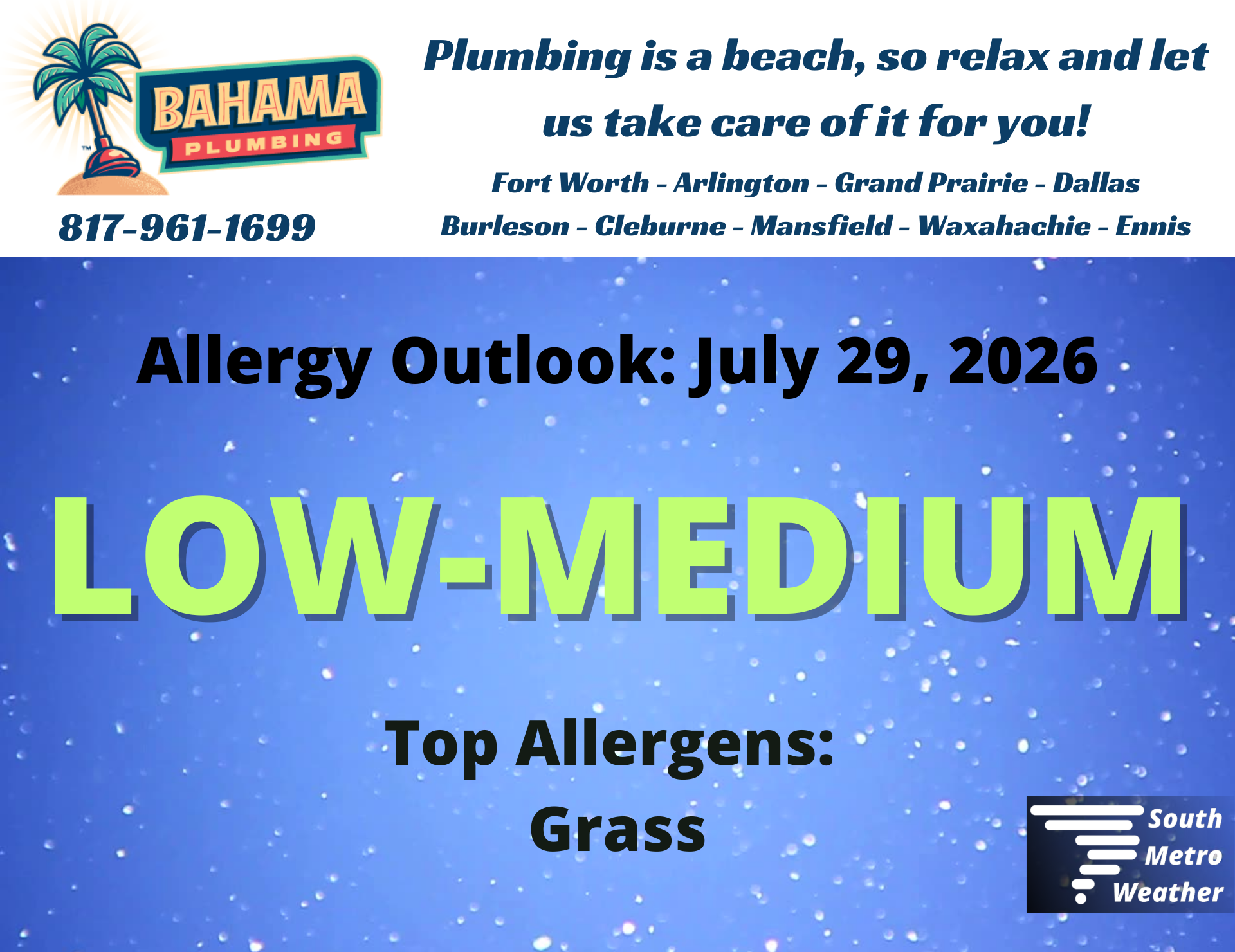
it gets hotter before it gets less hot
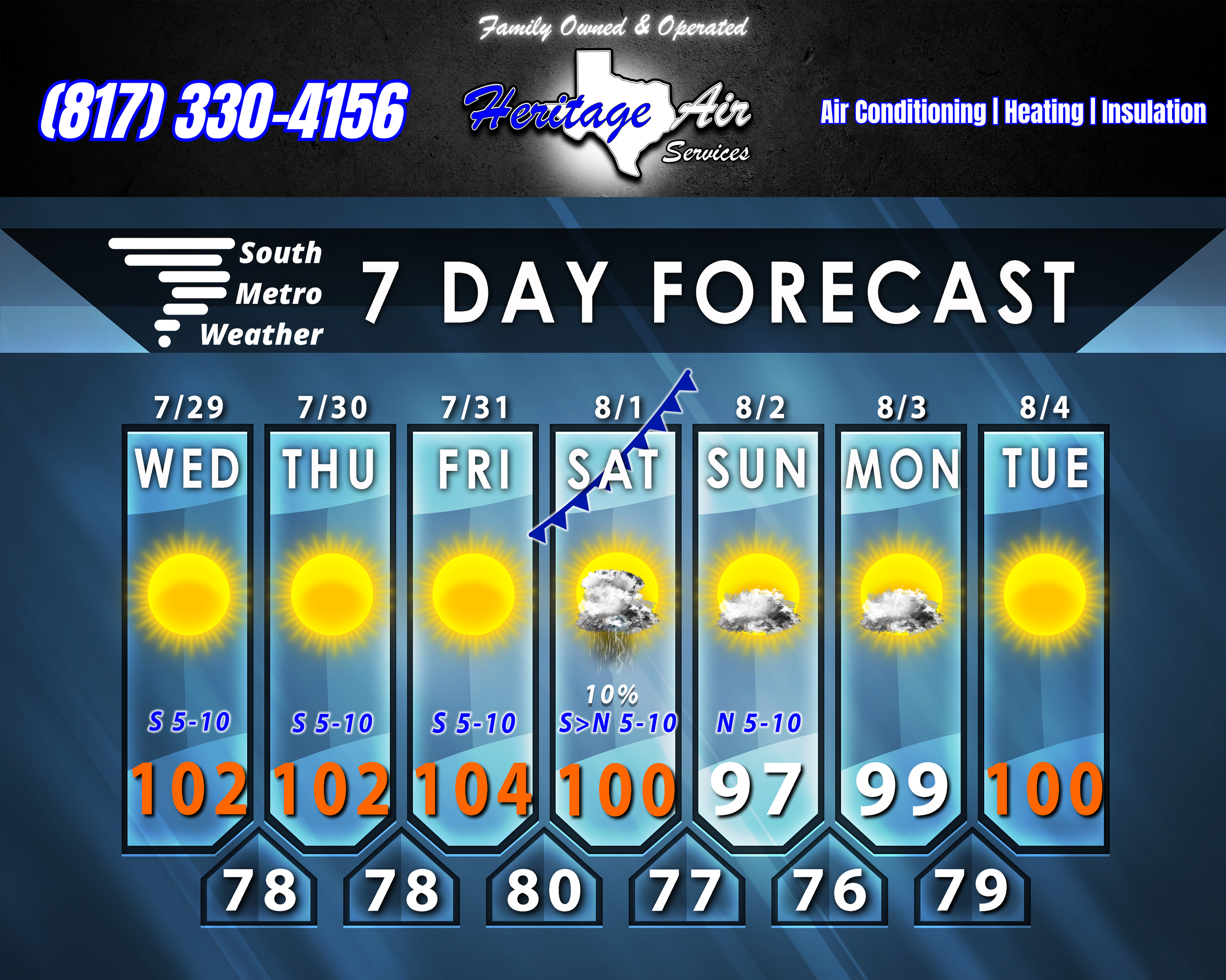
We’re still going uphill with our high temperatures, but a break from triple digits - however brief - is on the way.
Yesterday, Corsicana had the lowest high temperature at 98º - but the highest heat index value at 108º. That’s the magnitude of what we are seeing out there, so don’t let the air temp deceive you. The heat and humidity are not just making it uncomfortable - it’s dangerous. The heat makes us sweat, but the humidity makes evaporation less efficient, so our bodies can’t regulate temperature as well. That is why these conditions can cause rapid onset of heat-related illness.
We should all reach the triple digits today, and likely will for the next few days. Friday will be our hottest day, and the persistent Heat Advisories may shift to Extreme Heat Warnings. It will be absolutely crucial that we stay hydrated and take breaks when outside during the day.
A cold front arrives Saturday, and while we won’t get a big cool-down, we will get some drier air and a break from the triple digits for a couple of days. Saturday we’ll still reach the upper 90’s/around 100º, then Sunday and Monday we’ll top out in the upper 90’s. Winds will shift to the north behind the front, then from the east on Monday. By Tuesday, we’ll be back to the upper 90’s to around 100º. It’s only a brief break, but we’ll take it!
More triple-digit heat will be in store for August as high pressure returns. It’s impossible to say right now how much of August will remain this hot, but we usually start seeing more cold fronts in the latter half of the month. Keep in mind that September - at least, the first half of it - is hot, too, but I think we can at least say at this point we’re past the halfway point. Just hang on - fall is coming!