
big temp changes, little rain chances
Temperatures will fluctuate through the forecast, but little to no rain is expected.
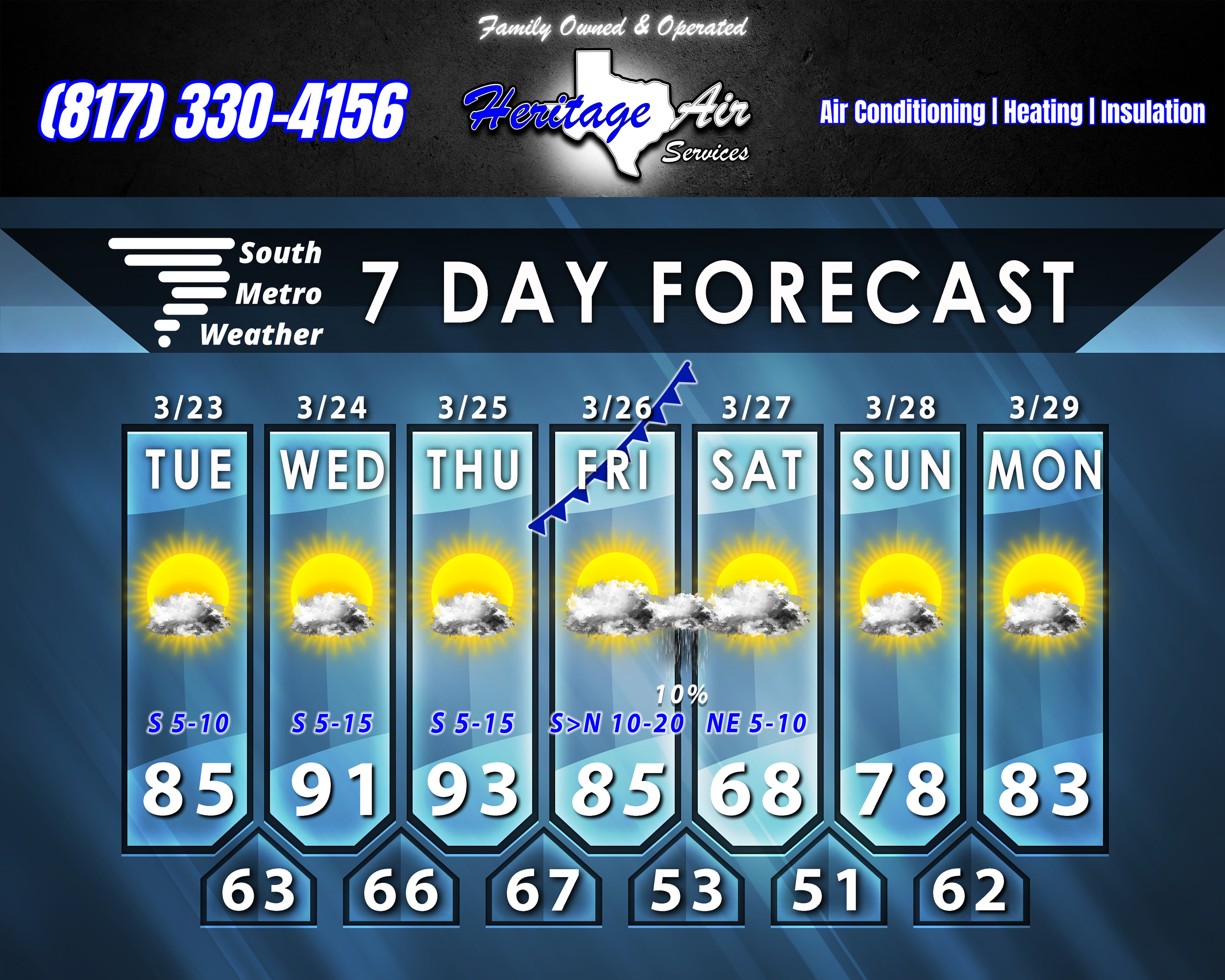
Today we warm up to the mid-80’s, then we’ll hit the low 90’s Wednesday and Thursday. Overnight lows will be in the 60’s. South winds will be modest today, but become more breezy Wednesday and Thursday. That increased flow from the south will bring in more gulf moisture as well, so expect higher humidity.
Friday a cold front moves in, and will pass through our area in the afternoon hours (no timeline yet). It will bring gusty north winds and cooler temperatures, with overnight lows dipping into the 50’s. Saturday we stay in the 60’s with modest northeast winds. Lows will be in the upper 40’s/low 50’s overnight into Sunday morning. Rain chances are low overall, with just a few showers possible overnight into early Saturday.
We’ll start warming up again Sunday with highs in the upper 70’s, and we’ll be in the low 80’s Monday. By this point we’ll see the overall pattern shifting, which should help increase rain chances by the end of next week.